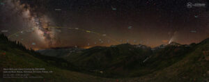
This afternoon at about 3 pm, the winds reached their peak for the day, and the smoke got very thick here in the Mtn. Ridge subdivision. Tate was home sick, so I was a captive audience until Heidi got home. I got to the top of North Table Mountain at about 10:20 pm, and the active part of the fire appears to be ~2 miles northwest. Winds were absolutely howling up there, and I frequently had to stabilize the tripod to prevent it from blowing over. There are still some hotspots on the ridgeline above the subdivision, but things look pretty good at the moment. Winds are forecast from the northwest tomorrow, so we’ll have to continue to cross fingers and toes that it doesn’t work it’s way back. If you want to see more images from today, please see the Indian Gulch Wildfire Day 1 slideshow on my website.
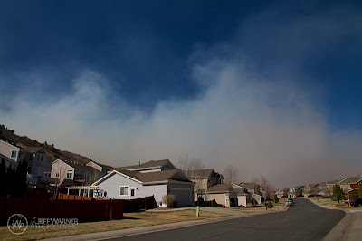 |
| About 2:30 pm, before the smoke engulfed the neighborhood. |
 |
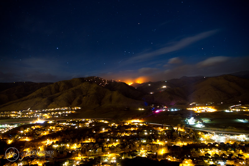
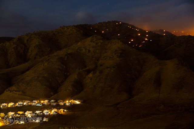
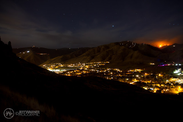
| Mtn. Ridge subdivision on the left; note the burnt summit of Mt. Galbraith, with numerous hotspots (probably tree stumps burning). Note the satellite above Mt. Galbraith. |
 |
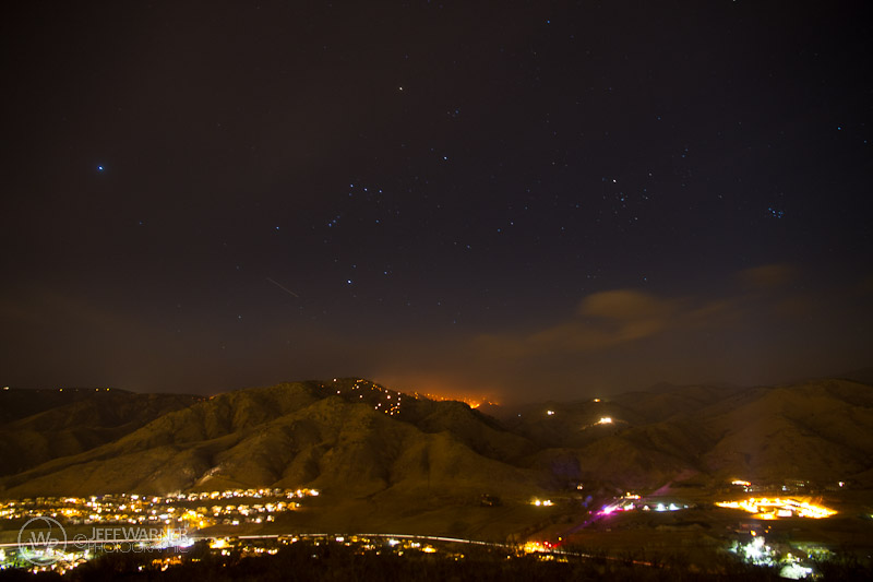
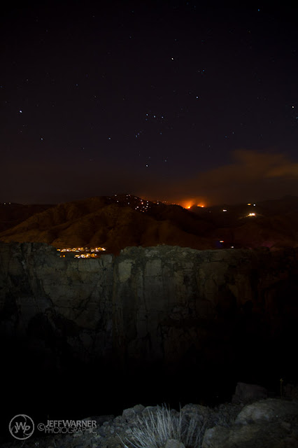
| Some of you who hike or mtn. bike North Table might recognize this rather unique ‘feature’. The arc of light is an emergency vehicle traveling up Golden Gate Canyon Rd., and note Orion and the Pleaiades. |
 |
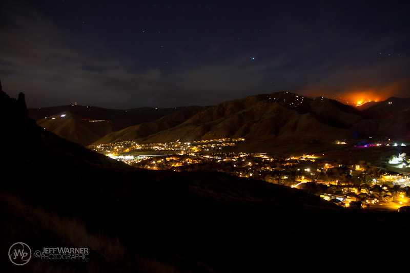
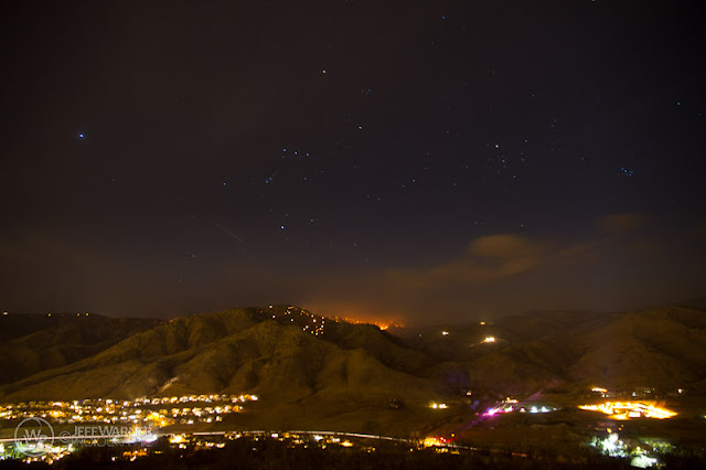
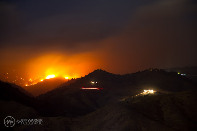
| Several flareups in Golden Gate Canyon (top of Mesa View Way at left of image). |
 |
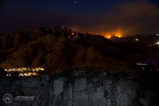
| The North Table Abyss. Kind of freaky in the dark! OK, maybe not ‘kind of’ freaky, REALLY freaky! |
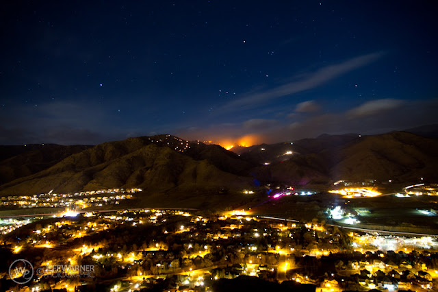 |
| Highway 93, Mesa Meadows, with the north part of Mtn. Ridge at left center of image. |
 |
| Mesa View Way and White Ash Drive. |
 |
| North Golden. |
 |
| Looking north along the west edge of North Table. |
 |
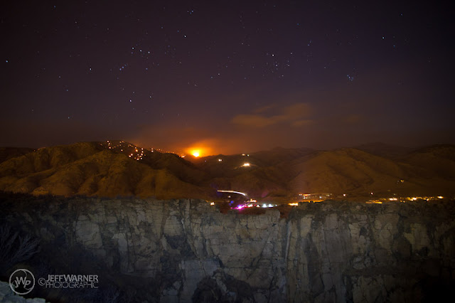
| Large flareup in Golden Gate Canyon. The line is an emergency vehicle heading toward the house (lights) just above, a property I’ve flown over countless times in the past en route to Central City. |